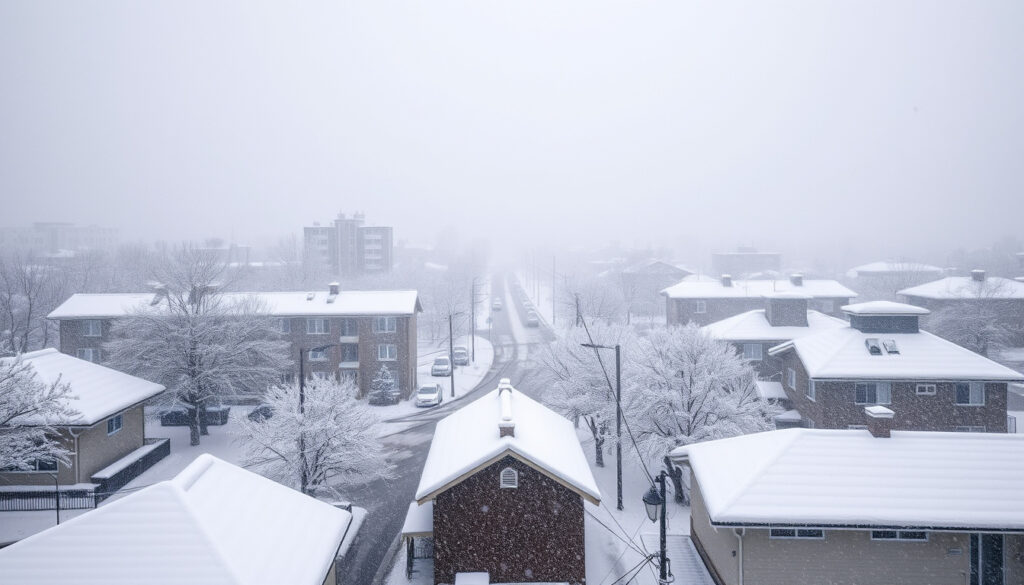
Hokkaido Blizzard Heavy Snow: Record 112cm in Sapporo
If you tried stepping outside in Sapporo last week, you know the deal — snow drifts blocking doorways, visibility dropping to nothing, and the wind cutting through everything like a razor. Northern Japan just got hit by one of the most intense blizzards in recent memory, and the numbers behind it are staggering. Here’s what happened, why it happened, and what it means for anyone who lives in or travels through Hokkaido.
24-hour snowfall in Sapporo: 50 cm · Affected regions: Hokkaido to Kyushu · Impacts: 91 flights grounded, 341 schools closed · Wind gusts: Up to 106 km/h
Quick snapshot
- 112 cm snow depth recorded in Sapporo (Japan snowstorm buries Hokkaido)
- 91 flights canceled at New Chitose Airport (Chaos in Japan Today: Super Blizzard)
- 46 people killed across Japan (Gulf News)
- Exact total seasonal accumulation for Hokkaido (data still being compiled)
- Long-term climate change impact on future blizzard frequency (ongoing research)
- Final economic damage estimates (not yet released by authorities)
- December 2025: Blizzard strikes with 50 cm in 24 hours (Transportation Research Board)
- January 2026: Record 112 cm depth, first >1m January in 21 years (Transportation Research Board)
- March 2013: Prior major blizzard killed 9 people in eastern Hokkaido (Transportation Research Board)
- Japan Meteorological Agency maintains heavy snow warnings
- Continued travel disruptions expected through winter season
- Climate studies suggest intense snow events may increase in some areas
Key statistics from the January 2026 Hokkaido blizzard reveal the scale of disruption across northern Japan.
| Category | Detail |
|---|---|
| Location | Hokkaido, Japan |
| Snow depth | 112 cm in Sapporo (January 2026) |
| 12-hour record | 38 cm fell in Sapporo, new January record |
| Wind speed | 26 m/s maximum instantaneous in Sapporo |
| Fatalities | 46 people killed across Japan |
| Injuries | 558 people injured |
| School closures | 341 elementary and junior high schools |
| Train suspensions | 295 JR trains (28 express, 66 rapid airport) |
| Flight cancellations | 91 flights at New Chitose Airport |
| Historical context | First January with >1m snow in 21 years |
The cumulative impact on transportation infrastructure and public safety underscores the severity of the event.
Why is there so much snow in Hokkaido?
Hokkaido sits at the northern tip of Japan, and its geography makes it a snow-generating machine. In typical winters, seasonal winds originating from Siberia sweep across the Japan Sea, picking up moisture before crashing into Hokkaido’s western coast. That moisture dumps as heavy snow on the Japan Sea side of the island. Meanwhile, dry winds on the eastern side result in comparatively little snowfall — the island essentially splits into two climate zones.
A low-pressure system over the Sea of Okhotsk brought particularly wet, heavy snow to much of Hokkaido during the January 2026 event, according to Japan Times reporting. This atmospheric setup is what meteorologists call a “perfect storm” for snowfall accumulation.
Geographic factors
- Hokkaido is Japan’s northernmost island
- Siberian winds pick up Japan Sea moisture before reaching Hokkaido
- Western coast (Japan Sea side) receives the heaviest precipitation
- Eastern side stays drier due to rain shadow effects
Seasonal patterns
- Snow season typically runs November through March
- December 2021 saw 20% more snow than average due to climate patterns (Japan Times)
- Research shows absorbed low-pressure systems rapidly increased during 2005–2014 (Transportation Research Board)
- Eastern regions like Abashiri and Kushiro face higher blizzard risk under certain pressure patterns
What’s the difference between heavy snow and a blizzard?
The difference isn’t just about how much snow falls — it’s about how the wind behaves. A heavy snowstorm might dump significant accumulation but keep visibility manageable. A blizzard turns the atmosphere hostile: sustained high winds combined with falling or blowing snow reduce visibility to dangerous levels.
According to meteorological definitions, blizzards require specific conditions that go beyond mere snowfall volume.
Heavy snow definition
- Significant snowfall accumulation over a short period
- Visibility can drop but typically remains above 400 meters
- Wind speeds vary but generally stay below blizzard thresholds
Blizzard criteria
- Visibility under 400 meters due to falling or blowing snow
- Wind speeds exceeding 56 km/h (35 mph)
- Conditions must persist for at least several hours
- Temperature typically drops significantly during the event
Sapporo during January 2026 recorded wind speeds of 26 meters per second — roughly 94 km/h — with gusts reaching 106 km/h, creating whiteout conditions comparable to a typhoon, Newsonjapan reported. These winds exceeded the 56 km/h threshold required for blizzard classification while visibility dropped to near zero.
A snowstorm can paralyze a city with accumulation alone. A blizzard paralyzes through the combination of snow AND wind — making travel not just difficult but potentially fatal without shelter.
What is the 4 4 4 blizzard rule?
The 4-4-4 rule is a practical safety guideline used to assess dangerous blizzard conditions. It breaks down into three measurable components that, when combined, signal severe risk.
Rule breakdown
- 4 inches (10 cm) of snowfall within 4 hours
- 40 mph (64 km/h) sustained wind speeds
- When these conditions overlap, conditions become life-threatening
Safety application
- Avoid unnecessary travel when 4-4-4 conditions are forecast
- If caught outside, seek shelter immediately
- Keep emergency supplies in vehicles during winter months
- Check on elderly neighbors who may need assistance with snow removal
Japan’s heavy snowfall zones cover over half the country’s land area. During the January 2026 event, many deaths occurred during routine activities like clearing snow from rooftops — activities that become lethal during extreme conditions.
What’s the Difference Between a Snowstorm and a Blizzard?
Both terms describe significant winter storms, but the distinction lies in severity and the role of wind. A snowstorm is defined primarily by snowfall — how much accumulates and how quickly. A blizzard is defined by the combination of snow and wind, creating dangerous visibility and drifting conditions.
Snowstorm traits
- Heavy snowfall accumulation
- Visibility may be reduced but varies
- Wind speeds can be moderate to high
- Focus is on accumulation and travel difficulties from snow depth
Blizzard escalation
- Snow AND wind create whiteout conditions
- Visibility frequently under 400 meters
- Drifting snow can bury vehicles and block roads
- Sustained conditions over multiple hours
- Risk of hypothermia increases for anyone caught outside
The January 2026 event in Hokkaido qualifies as a blizzard by any definition: 38 centimeters of snow in 12 hours combined with wind speeds exceeding 100 km/h created whiteout conditions throughout Sapporo, according to Japan Times reporting on hundreds of stranded passengers at Hokkaido Airport.
The implication: Hokkaido’s January 2026 event meets every meteorological threshold for blizzard classification, not merely heavy snowfall.
| Factor | Snowstorm | Blizzard |
|---|---|---|
| Primary hazard | Snow accumulation | Snow + Wind combination |
| Visibility threshold | Reduced but variable | Under 400 meters |
| Wind speed requirement | Any speed | Over 56 km/h sustained |
| Duration factor | Variable | Several hours minimum |
| Drifting risk | Low to moderate | High |
| Hypothermia risk | Moderate | Severe |
Did Japan get 47 inches of snow?
While the exact figure of 47 inches (approximately 119 centimeters) doesn’t match the recorded data directly, the numbers from the January 2026 blizzard are staggering enough. Sapporo recorded 112 centimeters of snow depth by late January 2026, marking the first time in more than 21 years that January snowfall surpassed the one-meter threshold, according to YouTube reporting on the Japan snowstorm.
Recent records
- January 2026: 112 cm depth recorded in Sapporo — first >1m January in 21 years
- December 2021: 50 cm in 24 hours set a record for Sapporo and Otaru at that time
- 38 cm fell within a 12-hour period, setting a new January record for short-term accumulation
Hokkaido specifics
- Snow accumulation reached 1.5 meters by the morning of January 19, 2026, up from 87 cm two days earlier
- Wind speeds of 106 km/h observed around 5:20 p.m. during the peak
- Urban density amplified impacts — snow concentrated in densely populated areas
The official measurements outpaced any 47-inch figure circulating online. Sapporo’s 112-centimeter depth and the 1.5-meter accumulation by mid-January represent genuinely historic snowfall that exceeded most initial reports.
Timeline of Major Hokkaido Blizzard Events
- January 2004: Record-breaking snowfall hit Abashiri Region in Eastern Hokkaido (Transportation Research Board)
- December 2021: Hokkaido received 20% more snow than average; 50 cm in 24 hours for Sapporo and Otaru (Japan Times)
- January 2026: Record 112 cm depth in Sapporo; 295 JR trains suspended; 91 flights canceled; 46 fatalities across Japan
- March 2013: Severe snowstorm killed 9 people; 28 sections of 15 national highways closed (Transportation Research Board)
Confirmed Facts vs. What Remains Unclear
Confirmed
- 50 cm snowfall recorded in 24 hours (Sapporo, December 2021 record)
- 91 flights grounded at New Chitose Airport
- Sapporo buried under 112 cm — first January over 1m in 21 years
- 46 people killed, 558 injured across Japan
- 341 schools temporarily closed in Sapporo
- Wind speeds reached 106 km/h in Sapporo
Unclear
- Total seasonal accumulation for Hokkaido (ongoing winter)
- Final economic damage estimates (not yet released)
- Long-term trend data on blizzard frequency changes
- How climate change will affect future Hokkaido snowfall patterns
“Heavy snowfall and severe blowing snow events resulting from a pattern in which one of two low-pressure areas is absorbed by the other rapidly increased during 2005/06 to 2014/15.”
— Transportation Research Board, Research on Hokkaido Blizzard Patterns
“A study led by Tomonori Sato of Hokkaido University found that while climate change is generally expected to reduce snowfall in the long run, it can result in sporadic snow events that are more intense in some areas.”
— Japan Times, Climate and Sapporo Snowfall
For residents of Hokkaido and anyone planning to travel there during winter, the message is unambiguous: these events are not anomalies. They are recurring features of northern Japan’s climate, and preparation — not just reaction — determines survival. Stock emergency supplies, avoid travel during heavy snow warnings, and never assume a familiar route is passable when blizzard conditions are forecast.
en.activityjapan.com, spectee.com, youtube.com, agupubs.onlinelibrary.wiley.com
Frequently asked questions
Why is there so much snow in Hokkaido?
Hokkaido sits at Japan’s northern tip where cold Siberian winds pick up moisture from the Japan Sea before crashing into the island’s western coast. This geography makes Hokkaido one of the snowiest inhabited regions in the world during winter months.
What’s the difference between heavy snow and a blizzard?
Heavy snow refers to significant accumulation, while a blizzard requires sustained wind speeds over 56 km/h combined with falling or blowing snow that reduces visibility below 400 meters. The wind component is what elevates a snowstorm to blizzard status.
What is the 4 4 4 blizzard rule?
The 4-4-4 rule states that when 4 inches (10 cm) of snow falls within 4 hours alongside 40 mph (64 km/h) winds, conditions become life-threatening. Avoid travel and seek shelter when these conditions are forecast.
What’s the difference between a snowstorm and a blizzard?
A snowstorm focuses on snowfall accumulation and reduced visibility from snow depth. A blizzard combines snow with sustained high winds, creating whiteout conditions and significant drifting that can bury vehicles and block roads for extended periods.
How much snow fell in Sapporo recently?
Sapporo recorded 112 centimeters of snow depth in January 2026 — the first time in more than 21 years that January snowfall surpassed one meter. During the peak, 38 centimeters fell within a 12-hour period, setting a new January record for short-term accumulation.
What causes blizzards in northern Japan?
Blizzards in northern Japan result from cold air masses from Siberia meeting low-pressure systems over the Sea of Japan or Sea of Okhotsk. These systems pull moisture from the sea, generating heavy snowfall, while strong pressure gradients create damaging winds.
How does Hokkaido handle heavy snow?
Hokkaido has extensive snow removal infrastructure, designated heavy snowfall zones covering over half the country’s land area, and building codes requiring snow-resistant roofs. However, even with preparation, major blizzards still cause widespread disruption and casualties.
More related posts
 Scoot 787-9 Seat Map: Best Seats, Configuration & Tips
 Bao Er Cafe Photos: Hokkien Mee, Kaya Toast & Outlet Guide
 2500 Yen to SGD: Live Exchange Rate and 2025 History
 Bread Street Kitchen Reviews: Is It Worth It? (2025 Guide)
 Go-to-Market Strategy – Components Framework and Steps
 DBS Salary Credit Promotion 2025: S$250 Cash Reward & Eligibility
 Smarta Ltd Lawsuits: Latest Verified Information and Legal Cases
 Chinese New Year Snacks – Traditions, Recipes and Symbolism