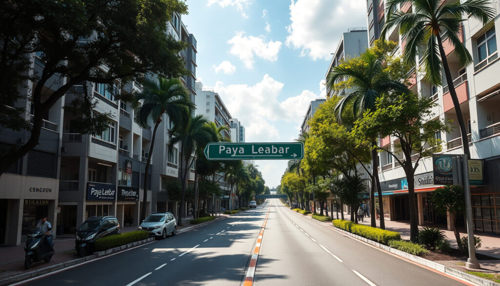
Upper Paya Lebar Road – Location, Access and Complete Guide
Upper Paya Lebar Road: Location, Access & Complete Guide
Upper Paya Lebar Road is a significant thoroughfare in northeastern Singapore, weaving through established neighborhoods that include Hougang, Serangoon, Kovan, Macpherson, and Upper Serangoon. The road serves as a key connector between residential estates, industrial zones, and commercial hubs, making it an important artery in the city’s northeastern corridor. GPS coordinates place the road at approximately 1.3434° N, 103.882° E, situating it within the broader Geylang planning area.
For residents, commuters, and visitors alike, understanding the layout and amenities surrounding Upper Paya Lebar Road can significantly improve navigation and help identify housing, shopping, and transportation options in this part of Singapore. The road’s extensive postcode range and proximity to major transport links make it a focal point for both daily commuters and those researching property opportunities in the northeast.
This guide compiles verified information from official sources including OneMap, the Land Transport Authority, and the Urban Redevelopment Authority to provide a comprehensive overview of Upper Paya Lebar Road’s location, access options, amenities, and development trajectory.
Where is Upper Paya Lebar Road Located?
Upper Paya Lebar Road sits within the Upper Paya Lebar region, bordering the Geylang planning area, the Paya Lebar Quarter development, and the Defu industrial estate. The road spans approximately 2-3 kilometers and passes through multiple distinct neighborhoods, including Macpherson, Upper Serangoon, and areas adjacent to Hougang and Kovan. Specific addresses along the road include notable locations such as 141A Upper Paya Lebar Road in the Macpherson area (postal code S534846) and Blk 179 in Upper Serangoon (postal code S534865).
Postcodes Along Upper Paya Lebar Road
The road’s considerable length means it covers numerous postal codes, primarily within the 53xxxx range. Documentation from postal databases indicates addresses distributed across codes including 533866, 533867 through 533875, 534049, 534102, 534235, 534386 through 534389, 534803, 534816 through 534870, and sequential codes extending to 534963 and beyond. A specific example is 534862, corresponding to 173 Upper Paya Lebar Road near the Hougang and Serangoon boundary. Full postcode listings can be verified through the Singapore Post official tool.
For precise address lookups, the Singapore Post postal code tool provides up-to-date information. OneMap also offers address-specific coordinates—for instance, 187 Upper Paya Lebar Road is recorded at latitude 1.3401 and longitude 103.8850.
Key Facts Snapshot
| Fact | Details |
|---|---|
| Planning Area | Geylang |
| Postcodes | 534xxx, 535xxx |
| Nearest MRT | Paya Lebar (EW8/CC9), Tai Seng (CC11) |
| Approximate Length | 2-3 kilometers |
| Key Roads Nearby | Defu Lane, Paya Lebar Road |
| GPS Coordinates | 1.3434° N, 103.882° E |
| Primary Land Uses | Residential HDB, shophouses, industrial |
- Strategically positioned between residential estates and industrial zones in Singapore’s northeast
- Serves as a boundary road between multiple planning areas including Geylang, Hougang, and Serangoon
- Benefits from proximity to the Paya Lebar Quarter mixed-use development
- Well-connected via both MRT and bus services, enhancing accessibility for residents
- Property values in the area have shown positive movement due to MRT connectivity improvements
- Offers diverse housing options ranging from HDB flats to shophouse units
How to Get to Upper Paya Lebar Road
Accessing Upper Paya Lebar Road is straightforward through multiple transport options. The road connects to the Pan-Island Expressway (PIE), making it easily reachable by car from most parts of Singapore. For public transport users, both MRT and bus services provide reliable access to points along the road.
Nearest MRT Stations
The nearest MRT station to Upper Paya Lebar Road is Tai Seng MRT on the Circle Line (CC11), located approximately four minutes’ walk from 141A Upper Paya Lebar Road. The broader area is also served by Paya Lebar MRT, an interchange station on both the East-West Line (EW8) and Circle Line (CC9), providing excellent connectivity to the city center and other parts of Singapore. Commuters can use the OneMap portal to plan routes from these stations to specific addresses along the road.
Bus Services Along Upper Paya Lebar Road
Multiple bus routes operate along Upper Paya Lebar Road, with stops positioned near HDB blocks, shophouses, and key landmarks. The Land Transport Authority manages these services, and real-time bus timing information is available through the OneMap portal and navigation applications. For driving directions with live traffic updates, the Waze platform offers up-to-date route information.
Walking and cycling paths connecting Upper Paya Lebar Road to nearby MRT stations and HDB estates are available through OneMap’s journey planning feature. The short walk from Tai Seng MRT to addresses like 141A Upper Paya Lebar Road takes approximately four minutes.
Driving and Parking
For those traveling by car, Upper Paya Lebar Road connects directly to the Pan-Island Expressway (PIE), one of Singapore’s major arterial highways. Parking facilities are available near HDB residential blocks and shophouse clusters along the road. OneMap provides detailed information on available parking lots and driving directions to specific addresses, such as 187 Upper Paya Lebar Road.
| Transport Mode | Details |
|---|---|
| Driving | Accessible via PIE; use Waze for live traffic |
| MRT | Tai Seng (CC11) or Paya Lebar (EW8/CC9) |
| Bus | Multiple stops along road; check OneMap for routes |
| Walking/Cycling | Paths to MRT and HDB areas via OneMap |
What Amenities and Shops Are Near Upper Paya Lebar Road?
Upper Paya Lebar Road features a blend of residential and commercial properties that provide essential amenities for local residents. Shophouse developments such as those at 141A Upper Paya Lebar Road house various retail shops and eateries typical of Singapore’s residential-commercial stretches. These shophouses offer everyday conveniences including minimarts, food outlets, and service shops that serve the surrounding HDB community.
Nearby Commercial Developments
The road benefits from proximity to the Paya Lebar Quarter, a major mixed-use development featuring offices, retail spaces, and dining options. This URA-led hub has transformed the area into a commercial center with expanded shopping and entertainment choices for residents. Additionally, the Geylang area—renowned for its diverse food scene and traditional amenities—lies nearby, providing further options for dining and leisure activities.
HDB residential blocks including Blk 179 and Blk 187 in the Upper Serangoon area are accompanied by local shops, wet markets, and essential services. The Defu area to the north offers industrial and commercial services that complement the residential amenities along Upper Paya Lebar Road.
Schools in the Area
No schools are located directly on Upper Paya Lebar Road itself. However, the surrounding northeast Singapore region, particularly areas near Kovan and Hougang, hosts primary and secondary schools serving the local population. Parents seeking school enrollment information for this zone should consult OneMap’s education layer or contact the respective school administrations directly for the most current enrollment details and proximity assessments.
What Is the History and Future of Upper Paya Lebar Road?
Upper Paya Lebar Road has developed alongside Singapore’s northeastern corridor over several decades. The area underwent significant transformation during the 1960s and 1990s as Singapore’s public housing program expanded, resulting in the construction of HDB residential blocks that now form the backbone of the neighborhood. Industrial growth in the Defu area during the 2010s added employment opportunities to the vicinity, creating a balanced live-work environment.
Key Developments and Planning
The Urban Redevelopment Authority oversees planning for the Upper Paya Lebar Road area through its Master Plan, which guides land use and development intensity. The Paya Lebar Quarter represents one of the most significant recent developments—a mixed-use hub integrating commercial and residential spaces that has enhanced the area’s attractiveness. The Land Transport Authority manages transportation infrastructure, while HDB continues to maintain the residential flats in the vicinity.
Property prices in the Upper Paya Lebar Road area fluctuate based on market conditions and proximity to new developments. For the most current property valuations and transaction data, consulting established property portals or engaging licensed property agents is recommended. The URA Master Plan provides official information on approved and proposed developments.
Property Context
The area includes a mix of HDB residential blocks (such as Blk 179 at postal code S534865 and Blk 187) and shophouse properties. Property values are influenced by factors including MRT accessibility, proximity to commercial centers like Paya Lebar Quarter, and overall neighborhood quality. While specific current prices vary and fluctuate with market conditions, the trend toward improved connectivity and amenities has supported property values in the corridor. Those interested in detailed property data should consult the HDB website for official resale statistics and the Singapore Land Authority for land-related information.
Development Timeline
The evolution of Upper Paya Lebar Road and its surrounding area reflects broader trends in Singapore’s urban development.
- 1960s: Post-airbase era marked the beginning of residential development in the northeastern corridor
- 1990s: Major HDB housing blocks constructed, establishing the residential character of the area
- 2010s: Industrial expansion in the Defu zone added employment hubs to the vicinity
- Late 2010s: Paya Lebar Quarter mixed-use development commenced, integrating commercial and residential functions
- 2020s: Continued integration of the Paya Lebar Quarter with enhanced transport connectivity and community amenities
What Is Certain and Uncertain About Upper Paya Lebar Road
When researching Upper Paya Lebar Road, distinguishing between established facts and areas requiring further verification helps set realistic expectations for visitors, residents, and property seekers.
| Established Information | Information Requiring Further Verification |
|---|---|
| Fixed location and postcodes verified via OneMap and Singapore Post | Current property prices and market trends |
| MRT connectivity via Tai Seng and Paya Lebar stations | Specific school enrollment zones and catchment areas |
| Bus routes operated by LTA | Pending development approvals subject to URA review |
| Proximity to Paya Lebar Quarter and Defu industrial area | Exact opening dates for future commercial tenants |
| HDB residential blocks (Blk 179, 187, etc.) | Detailed future infrastructure upgrades |
| Planning authority oversight by URA and HDB | Specific rental rates for commercial shophouses |
Planning Context and Regional Role
Upper Paya Lebar Road plays an important role in Singapore’s northeastern urban ecosystem. As a boundary road between multiple planning areas, it serves as a connective tissue linking residential neighborhoods with employment centers. The road’s position between established HDB estates and emerging commercial hubs like Paya Lebar Quarter creates a dynamic environment that balances housing needs with economic activity.
The area’s connectivity to the CBD via the East-West Line and Circle Line makes it attractive for residents seeking accessibility without central area costs. Meanwhile, the proximity to Defu’s industrial zone provides employment opportunities for residents preferring shorter commutes. The URA Master Plan continues to guide development patterns, with OneMap serving as the central resource for viewing zoning overlays and planned infrastructure.
Sources and References
The following official sources provided the information compiled in this guide:
OneMap (URA/LTA): Interactive maps and address verification tool providing coordinates for locations including 187 Upper Paya Lebar Road at lat 1.3401, lng 103.8850
Singapore Post: Official postal code lookup service for verifying addresses along Upper Paya Lebar Road
Urban Redevelopment Authority: Master Plan documentation for development zones including Paya Lebar Quarter
Summary
Upper Paya Lebar Road represents a significant thoroughfare in Singapore’s northeastern corridor, spanning approximately 2-3 kilometers through established residential areas and emerging commercial zones. The road offers accessible public transport options via Tai Seng and Paya Lebar MRT stations, multiple bus services, and connections to the Pan-Island Expressway for drivers. Residents benefit from nearby amenities including shophouses, the Paya Lebar Quarter development, and essential services in surrounding HDB estates. The area continues to evolve under guidance from the Urban Redevelopment Authority, with future developments likely to enhance connectivity and commercial offerings. For those considering residence in the area, proximity to MRT stations and established neighborhood amenities make Upper Paya Lebar Road a practical option in Singapore’s northeastern region.
Frequently Asked Questions
What is the postcode for Upper Paya Lebar Road?
Upper Paya Lebar Road addresses fall primarily within the 53xxxx range, including codes such as 534846, 534865, 534869, and many others distributed along its length. Specific postcodes vary by address and can be verified through Singapore Post’s official tool.
Are there shops or eateries on Upper Paya Lebar Road?
Yes, shophouse developments along Upper Paya Lebar Road, including those at 141A Upper Paya Lebar Road, house retail shops and food outlets serving the local community. The nearby Paya Lebar Quarter offers additional dining and shopping options.
Which schools are near Upper Paya Lebar Road?
No schools are located directly on Upper Paya Lebar Road itself. However, primary and secondary schools serve the broader northeast Singapore area, particularly near Kovan and Hougang. Enrollment zone details should be confirmed directly with schools or through OneMap’s education layer.
Is there parking available on Upper Paya Lebar Road?
Parking is available near HDB blocks and shophouse areas along Upper Paya Lebar Road. OneMap provides information on parking lots and driving directions to specific addresses.
What upcoming developments are near Upper Paya Lebar Road?
The Paya Lebar Quarter represents the most significant recent development, with ongoing integration of commercial and residential spaces. The Urban Redevelopment Authority’s Master Plan guides future developments. OneMap offers overlays showing planned zoning changes.
How do I get to Upper Paya Lebar Road by car?
Upper Paya Lebar Road connects to the Pan-Island Expressway (PIE). Navigation applications like Waze provide live traffic updates and routing to specific addresses along the road.
Which MRT station is nearest to Upper Paya Lebar Road?
Tai Seng MRT (Circle Line, CC11) is the nearest station, approximately four minutes’ walk from addresses such as 141A Upper Paya Lebar Road. Paya Lebar MRT (EW8/CC9) also serves the broader area.
What are property prices like on Upper Paya Lebar Road?
Property values in the area include HDB resale flats and shophouse units, with prices influenced by MRT proximity and nearby developments. Current market data should be obtained from property portals or licensed agents, as prices fluctuate with market conditions.
More related posts
 Samwoh Corporation Pte Ltd: Quiet Giant of Singapore Construction
 Garnier Vitamin C Serum Guide: Benefits, How to Apply, and More
 Ang Mo Kio Interchange: Buses, Location & Rare Facts
 Good Morning Tuesday Blessings – Quotes, Prayers and Bible Verses
 How to Grill Vegetables: Best Methods, Times, and Common Mistakes
 StarHub Prepaid Top Up: How to Add Credit Online & App Guide
 Đổi Tiền Singapore Sang Tiền Việt – Current Rates and Best Locations
 First REIT Share Price: Target, History, and Why It Dropped